Project Title:
Revealing Reefs: Spatial Thinking for Community-Led Marine Conservation in the East Bali MPA
Project Summary
There is an urgent need for effective, community-based marine protected area (MPA) management in Indonesia during the UN Decade on Ecosystem Restoration (2021–2030). Although Indonesia lies at the heart of the Coral Triangle with the highest coral reef biodiversity globally, most of its 400+ MPAs remain under-managed, with none currently rated as sustainably managed (Meilana et al., 2023). Local enforcement and community engagement remain major challenges to achieving Indonesia’s “30 by 30” biodiversity goals. Conservation non-governmental organizations (NGOs) have started to successfully work with local communities to facilitate community-based MPAs around Southeast Asia (White et al. 2022).
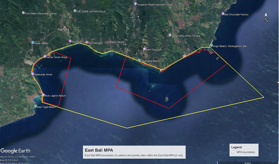
To address these challenges, our team is using spatial visualization and immersive education tools to “bring coral reefs to communities.” The NUS TRE Lab is working with local NGO Livingseas Foundation—led by Director Leon Boey and his team of 30 community-based conservation divers. We will co-develop the East Bali MPA management strategy with community organizations and schools. Participatory mapping and accessible reef visualization will help identify biodiversity hotspots, evaluate restoration progress, and select new restoration sites. Using Green Lidar mapping, underwater drones and AI-powered interpretation, side-scan sonar, and 3D photogrammetry, we have started to map reef extent, condition, and recovery over time. These spatial data will support community-driven zoning, management, and storytelling.
We are planning community engagement activities include visualisation and mapping workshops, MPA patrol trainings, as well as, coral planting and snorkeling excursions from the Livingseas pontoon. We will produce 360° immersive, experiential films showcasing the East Bali MPA’s coral reefs and Livingseas’ restoration efforts to show on VR headsets at schools and community events.
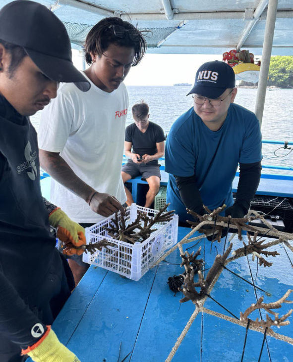
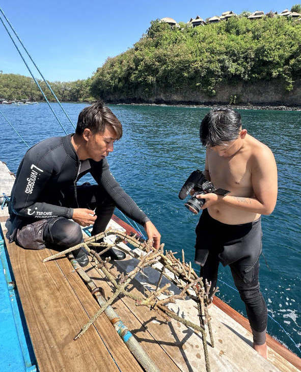
NUS graduate student and Livingseas local conservation divers tie coral fragments to a reef star before placing it on the artificial reef.
The place-based project leverages interdisciplinary methods—geospatial technologies, storytelling, experiential learning, and collaborative planning—to engage communities in protecting marine ecosystems in Padangbai, Bali, Indonesia. The result will be an inclusive, replicable model for locally managed MPAs around Bali, and across Indonesia’s 400 MPAs.
Our project seeks to drive transformational change in coral reef conservation through spatial thinking, place-based education, and community empowerment. Our primary goal is to co-develop a community-led East Bali MPA, grounded in local knowledge and designed as a scalable model for other Indonesian coastal regions.
To achieve this, we focus on four core objectives:
Community Empowerment and Behaviour Change:
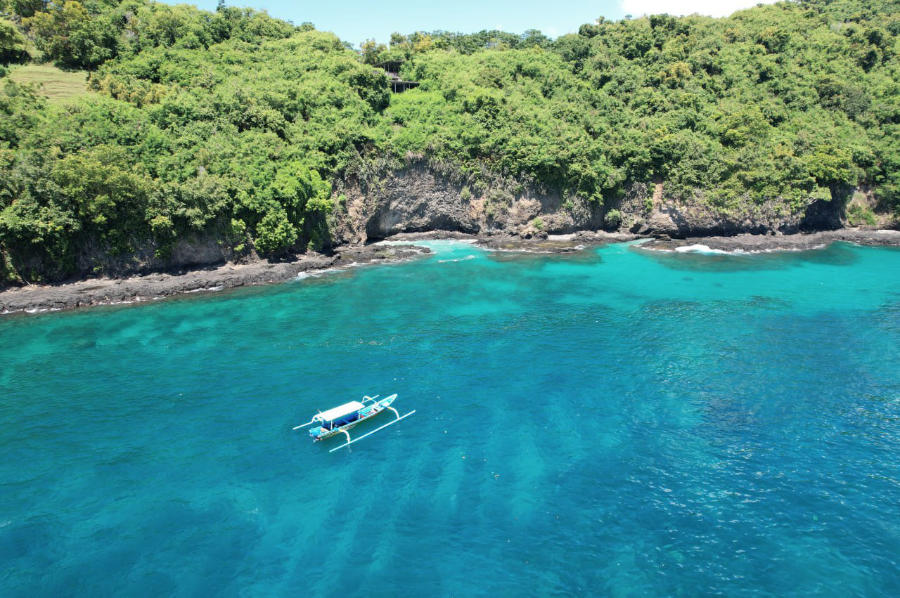
Using place-based, experiential learning—snorkelling, coral planting, and immersive 360° VR—we foster a deep emotional connection to the reef. Participants will come to understand how their daily actions (e.g., fishing, waste disposal) affect reef health and what they can do to help. This spatial and sensory awareness makes the invisible visible and promotes lasting behavioural change.
Marine Spatial Planning and Capacity Building:
Livingseas community conservation team will engage local stakeholders using spatial thinking to visualize reef systems and co-create spatial data during mapping and zoning workshops. They will use underwater drone mapping, AI interpretation, 3D photogrammetry, and side-scan sonar will help identify and visualise biodiversity hotspots and monitor restoration success. This will empower community groups like POKMASWAS to participate in zoning decisions, leading to better management of the East Bali MPA. We will conduct training with other MPAs and NGOs conducting coral reef restoration around Bali and Lombok to scale-up the project’s impact.
Education and Policy Engagement:
Coral reef maps will be shared with schools and communities in East Bali through in-person outreach and an online spatial learning portal. The portal will host mapped restoration sites, immersive videos, and public data to support marine spatial planning and national policy. These place-based education tools will support broad and inclusive engagement.
Advancing Global Restoration Goals:
This initiative directly contributes to the UN Decade on Ecosystem Restoration and Indonesia’s “30 by 30” target – 30% protection by 2030. By uploading coral mapping and restoration data to Restor.eco, we will increase transparency, connect to global networks, and attract long-term conservation investment. Our scalable, spatially driven model promotes ecosystem literacy and action across Indonesia’s MPAs.
Learning Methods & Activities:
- Coral planting and snorkelling excursions
- Spatial mapping and reef visualization workshops
- VR 360 coral reef and MPA film screenings in schools and public events
- Peer-led MPA patrol training sessions
Learning Outcomes:
- Identify coral species and endangered marine species
- Appreciate coral reef ecosystem services
- Understand MPA boundaries and functions
- Apply spatial mapping tools to assess reef health
- Connect local behaviour to reef outcomes
- Engage in coral restoration and long-term stewardship
Reference
Meilana, L., Fang, Q., Susanto, H.A., Widiastutik, R., Syaputra, D.E., Ikhumhen, H.O., Sholihah, R., Hakim, A., Yang, S. and Liu, Z., 2023.
How Indonesian marine protected areas (MPAs) are doing: A management performance-based evaluation.
Biological Conservation, 282, 110033.
White, C.M., Mangubhai, S., Rumetna, L. and Brooks, C.M., 2022.
The bridging role of non-governmental organizations in the planning, adoption, and management of the marine protected area network in Raja Ampat, Indonesia.
Marine Policy, 141, 105095.
